Username
Password
Remember Me
Fields marked with an asterisk (*) are required.
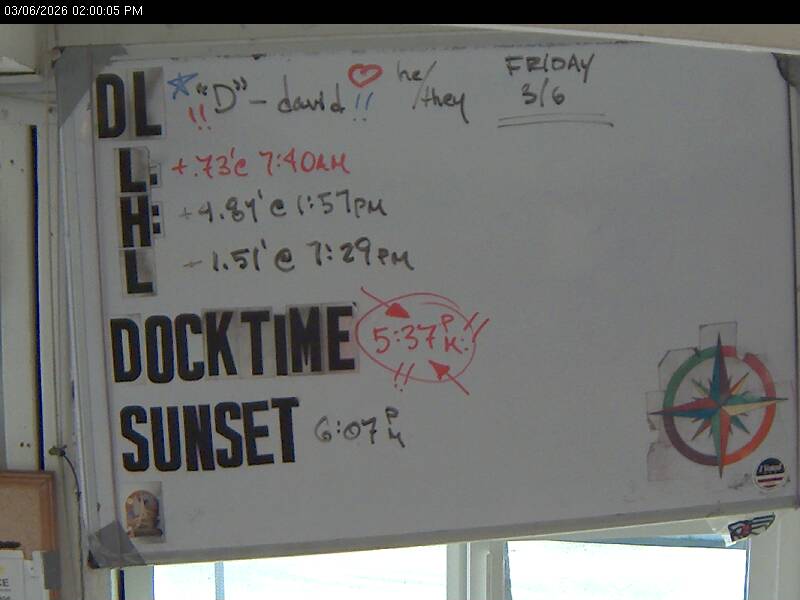
Today's Open/Close Times based on tide predictions
red means the Club will be closed. Note that current low tides are around 0.7 feet higher than predictions.
Day Leader's WhiteBoard
Unless whiteboard shows today's date, there is no Day Leader or they haven't signed in yet.
In order to perform the actions that you were trying to perform, you will need to login to the site.