Sailing/Windsurf Areas
These are the sailing and windsurf areas for each of the ratings: Novice, Junior, Senior, and Cruise. These are taken directly from the CSC Operating Rules.
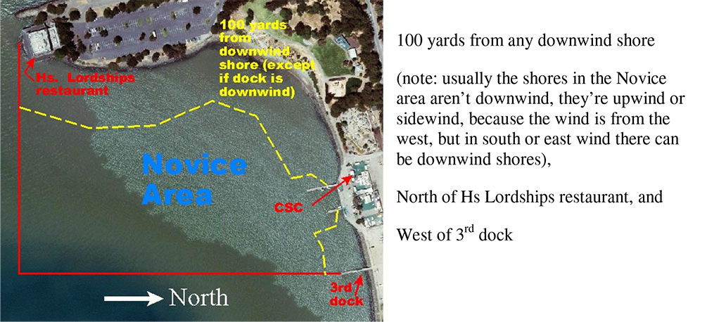
Novice Sailing/Windsurfing Area
Junior Sailing/Windsurfing Area
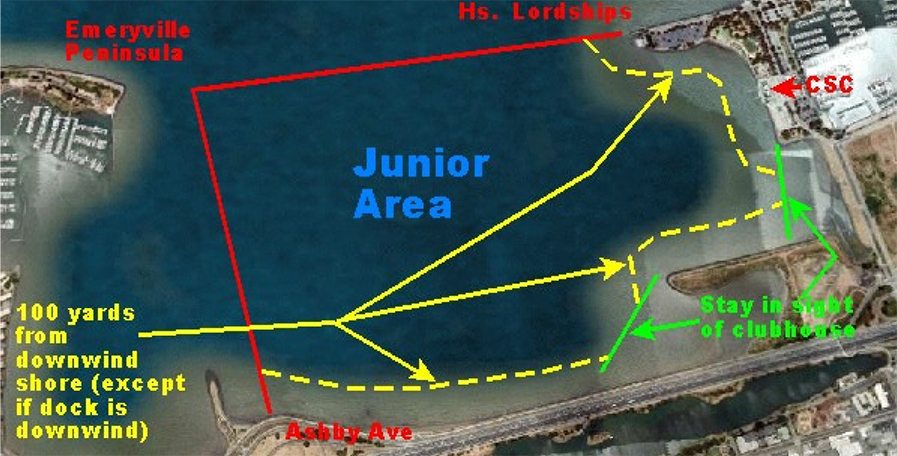
Within sight of clubhouse, 100 yards from any downwind shore except to dock, north of Ashby
Ave, and east of a line from the Emeryville Peninsula to Hs Lordships restaurant.
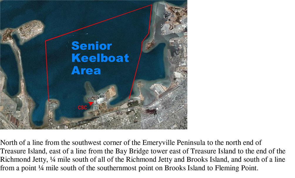
Senior Dinghy/Windsurfing Area
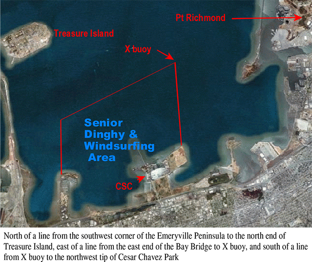
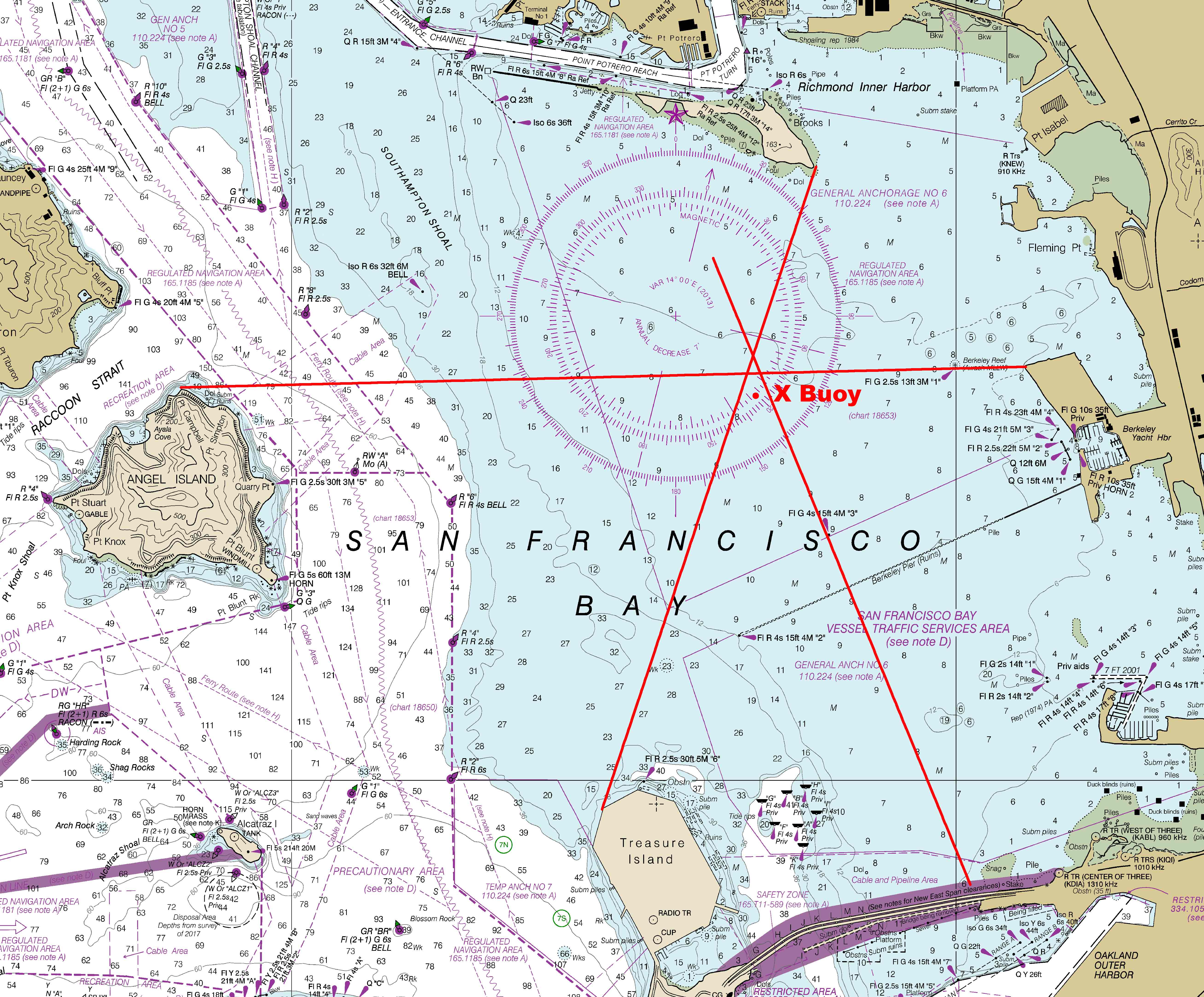
If the X buoy is not in service, the X buoy location is assumed to be the GPS coordinates 37°52.34' N 122°21.51' W Ranges can be used to get a good approximation to this location: the intersection of the following ranges: 1. from the north end of Caesar Chavez Park to the north end of Angel Island and 2. from the east end of Brooks Island to the visible west end of Treasure Island. Note that the X buoy location is on the range through the #3 channel mark near the Berkeley Pier to the east end of the Bay Bridge. These ranges are shown here:
Senior Keelboat Area
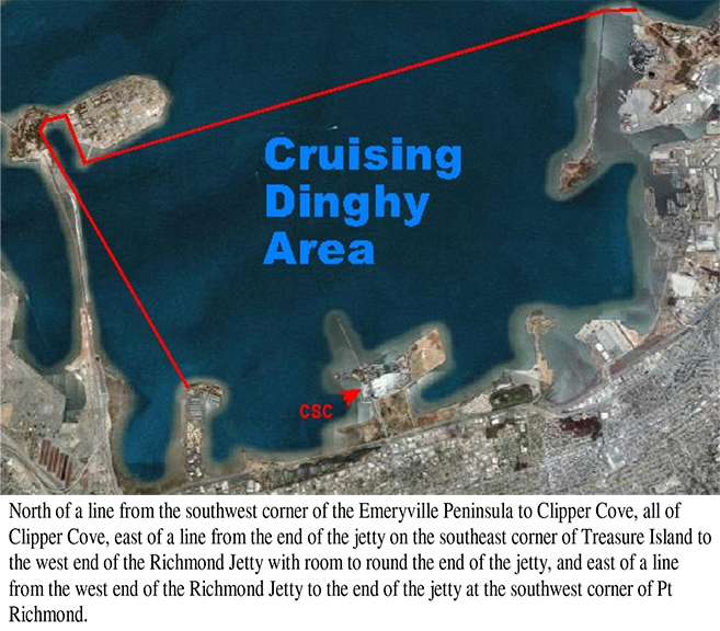
Cruising Dinghy Area
Cruising Keelboat Area
The inland and tributary waters of the San Francisco Bay and outside of the Golden Gate
no further west than a straight line drawn from Point Bonita Light through Mile Rocks
Light to the San Francisco shore.